


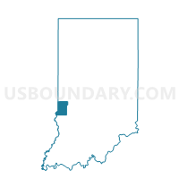
FAYETTE-A, Vigo County, Indiana
About
Outline

Summary
| Unique Area Identifier | 581016 |
| Name | FAYETTE-A |
| County | Vigo County |
| State | Indiana |
| Area (square miles) | 27.03 |
| Land Area (square miles) | 26.87 |
| Water Area (square miles) | 0.17 |
| % of Land Area | 99.38 |
| % of Water Area | 0.62 |
| Latitude of the Internal Point | 39.57135680 |
| Longtitude of the Internal Point | -87.48791140 |
Maps


Graphs
Select a template below for downloading or customizing gragh for FAYETTE-A, Vigo County, Indiana


Neighbors
Neighoring Voting District (by Name) Neighboring Voting District on the Map
- CLINTON TOWNSHIP 3, Vermillion County, IN
- ELBRIDGE Voting District, Edgar County, IL
- FAYETTE-B, Vigo County, IN
- STRATTON Voting District, Edgar County, IL
- SUGAR CREEK-A, Vigo County, IN
- SUGAR CREEK-E, Vigo County, IN
Top 10 Neighboring County Subdivision (by Population) Neighboring County Subdivision on the Map
- Clinton township, Vermillion County, IN (9,119)
- Sugar Creek township, Vigo County, IN (7,153)
- Fayette township, Vigo County, IN (2,630)
- Elbridge township, Edgar County, IL (830)
- Stratton township, Edgar County, IL (481)
Top 10 Neighboring Place (by Population) Neighboring Place on the Map
- St. Mary of the Woods CDP, IN (797)
- Tecumseh CDP, IN (658)
- New Goshen CDP, IN (390)
- Shepardsville CDP, IN (237)
Top 10 Neighboring Unified School District (by Population) Neighboring Unified School District on the Map
- Vigo County School Corporation, IN (107,848)
- South Vermillion Community School Corporation, IN (11,729)
- Paris Community Unit School District 4, IL (4,747)
Top 10 Neighboring State Legislative District Lower Chamber (by Population) Neighboring State Legislative District Lower Chamber on the Map
Top 10 Neighboring State Legislative District Upper Chamber (by Population) Neighboring State Legislative District Upper Chamber on the Map
Top 10 Neighboring 111th Congressional District (by Population) Neighboring 111th Congressional District on the Map
Top 10 Neighboring Census Tract (by Population) Neighboring Census Tract on the Map
- Census Tract 705, Edgar County, IL (4,050)
- Census Tract 103, Vigo County, IN (3,747)
- Census Tract 104, Vigo County, IN (3,626)
- Census Tract 204, Vermillion County, IN (2,005)
Top 10 Neighboring 5-Digit ZIP Code Tabulation Area (by Population) Neighboring 5-Digit ZIP Code Tabulation Area on the Map
- 61944, IL (12,908)
- 47842, IN (10,085)
- 47885, IN (9,009)
- 47876, IN (394)
- 47884, IN (229)
- 47863, IN (205)